The Dutch got tired of the sea flooding them, so they walled off an entire arm of the ocean and grew a province on the bottom
For centuries the Zuiderzee, a wide salt bay of the North Sea, drowned the heart of the Netherlands every time a winter storm pushed it inland. In 1932 the Dutch did something no nation had tried at this scale. They sealed the bay off with a 32 kilometre dam, turned the sea into a freshwater lake, and then pumped out the bottom to make new land.
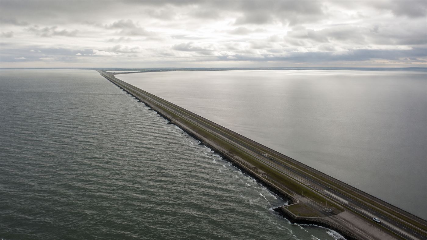
The Afsluitdijk, 32 km of dam, with the old sea on one side and the new lake on the other. Illustration: Watts & Wild.
The breaking point came on the nights of 13 and 14 January 1916. A winter storm drove the Zuiderzee over its dikes in several places and flooded the land behind them. The Netherlands had lived with that threat for generations, but this time the country had had enough. Within two years, on 14 June 1918, parliament passed the Zuiderzee Act and committed to a plan that had been waiting in a drawer for almost three decades.
That plan belonged to one man. The engineer Cornelis Lely had drawn up the first detailed scheme to close and reclaim the bay back in 1891, and had spent his career as an engineer and three times as a government minister pushing for it. He did not live to see it finished. Lely died in 1929, three years before the sea was shut, and the new capital built on the reclaimed land, Lelystad, carries his name. It is a city that sits where ships once sailed, named for the man who imagined draining the water beneath it.
How the Dutch sealed off the Zuiderzee
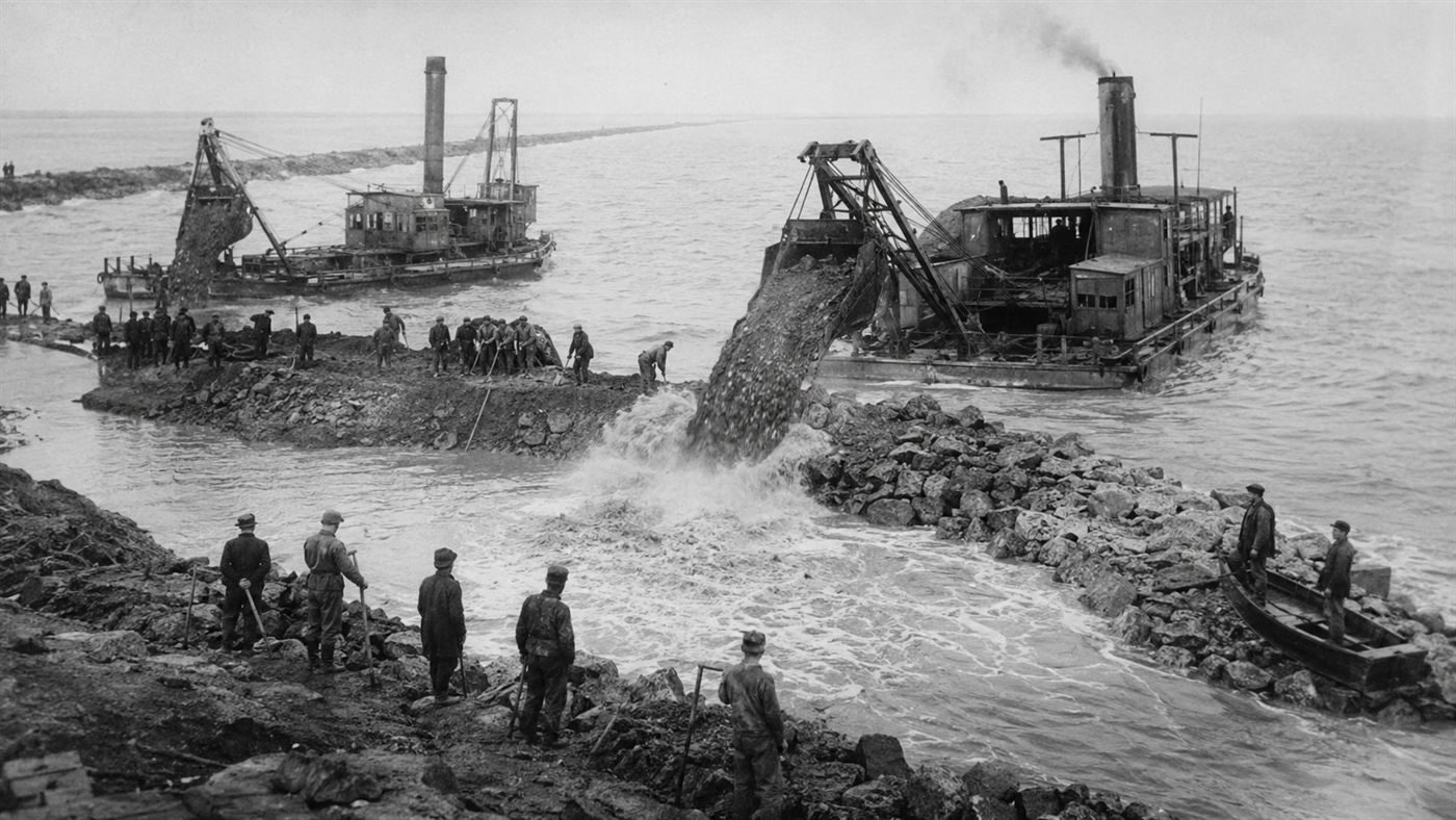
The centrepiece was the Afsluitdijk, the Closure Dam. As Holland.com describes it, the dam runs 32 kilometres from Den Oever in North Holland to the village of Zurich in Friesland, a thin grey line of clay and boulders thrown straight across open water. Building it between 1927 and 1932 took an army of effort: around 10,000 workers, 27 large dredges, 13 floating cranes, 132 barges and 88 tugs.
The hardest moment was the last one. Closing the final tidal gap meant racing the sea itself, dropping fill faster than the rushing tide could wash it away. On 28 May 1932 the crews filled the last channel, the Vlieter, and the Zuiderzee was shut, according to records of the Zuiderzee Works, fully two years ahead of forecast. The salt water behind the dam, slowly flushed by the rivers flowing into it, became fresh. The Zuiderzee was gone, and in its place lay the IJsselmeer, today the largest lake in Western Europe.
Growing a province on the seabed
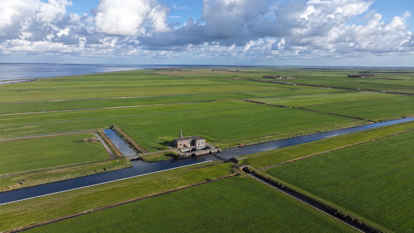
Sealing the bay was only half the idea. With the water now calm and fresh, engineers could ring off sections of the old seabed with smaller dikes and pump them dry, a technique the Dutch had used for centuries on a smaller scale. Here they did it on a giant one. Four great polders emerged from the water: Wieringermeer, the Noordoostpolder, and Eastern and Southern Flevoland, together about 1,650 square kilometres of brand new land.
On that reclaimed ground the Netherlands grew farms, towns and roads where there had been waves. In 1986 it became an entirely new province, Flevoland, often described as the largest artificial island in the world. People now live ordinary lives, raise crops and commute to work on a surface that within living memory was the floor of a sea. Few places on Earth make the power of engineering feel so literal.
What happened to the Zuiderzee fishing villages?
For all its triumph, the project killed a world. The Zuiderzee had been a working sea, full of herring and anchovy, and generations of villages along its shores had lived by fishing it. When the dam went in and the water turned fresh, the saltwater fish died out and that whole economy collapsed almost overnight.
The old island communities of Urk and Schokland, once surrounded by water, found themselves stranded in the middle of fields, their island status simply erased. Some towns reinvented themselves, but the loss was real. The same engineering that protected millions from drowning also drained away a centuries-old way of life, and the people who paid that price were the fishermen who had known the bay best.
The honest catch
It is worth being clear about the trade-offs. The Zuiderzee Works are rightly celebrated, but they replaced a living saltwater ecosystem and its fisheries with a managed freshwater lake and farmland, an enormous ecological change dressed up as pure progress. The phrase "largest artificial island" also needs an asterisk, since Flevoland is reclaimed polder rather than a heaped-up island in the usual sense.
And the work is never quite done. The Afsluitdijk that has held the sea back since 1932 is now being reinforced and raised to cope with rising sea levels and fiercer storms, a reminder that holding off the ocean is not a one-time victory but a permanent commitment. A country that is largely below sea level does not get to stop maintaining the walls.
Why the Zuiderzee Works still matter
Strip away the dates and the figures and you are left with something genuinely staggering: a nation that decided the map was wrong and changed it. The Zuiderzee exists now only in old charts and the memories of fishing families, replaced by a lake and a province full of people who never saw the sea that used to be there.
As coasts everywhere brace for higher water, the Dutch experiment looks less like history and more like a preview of choices other countries may face. Would you trust engineering to wall off a sea and grow land on the bottom, or does erasing a whole bay feel like a step too far? Tell us in the comments.
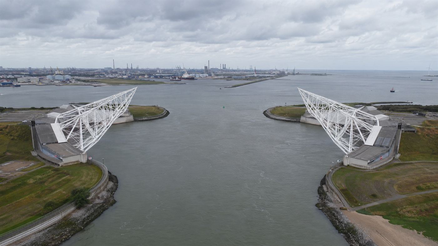
Related reading: Two steel arms the size of the Eiffel Tower swing shut by themselves to stop the North Sea from drowning Rotterdam.