The Dutch did not just hold back the sea, they erased an entire sea from the map, damming off the Zuiderzee with a 32 km wall and turning salt water into farmland
Most countries fight the sea by building higher walls. The Netherlands once did something far more audacious: it took a wild arm of the North Sea, the Zuiderzee, and simply closed it off behind a single ruler-straight dam, the Afsluitdijk. Behind that wall the salt water turned fresh, the storms went quiet, and a whole new province rose from the drained mud.
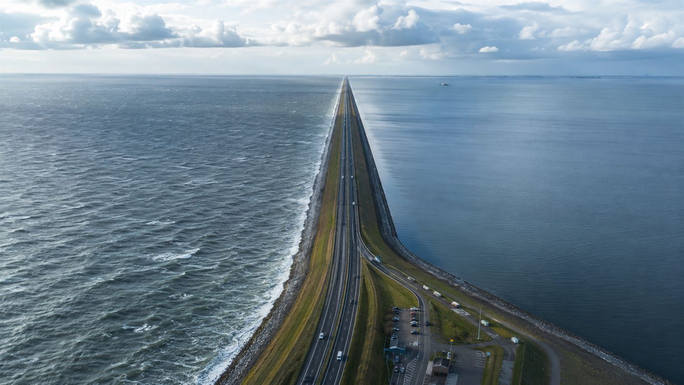
The Afsluitdijk runs arrow-straight for 32 kilometres, sea on one side, lake on the other. Illustration: Watts & Wild.
Look at an old map of the Netherlands and you will see a great bite taken out of its middle: the Zuiderzee, a shallow, stormy bay of the North Sea that reached deep into the heart of the country. It fed fishing towns and drowned them by turns. Today that bay is gone, replaced by a calm lake and flat green fields, and the thing that did it is a dam you can drive across in about twenty minutes.
The Afsluitdijk, which translates roughly as the closure dyke, is one of the boldest pieces of civil engineering ever attempted. It did not merely defend the land from the water. It rewrote the coastline, converting an entire sea into a freshwater lake and clearing the way for the largest land reclamation project the world had ever seen.
Why the Afsluitdijk was built
For centuries the Dutch had dreamed of taming the Zuiderzee, but the dream needed both a workable plan and a disaster to force the issue. The plan came from an engineer named Cornelis Lely, who in 1891 laid out a detailed scheme to wall off the bay and reclaim the land behind it. For years it sat on the shelf, too expensive and too daring for anyone to commit to.
Then the sea made the argument for him. As Wikipedia records, in January 1916 a winter storm drove the water over the dykes around the Zuiderzee and flooded the land behind them. The shock of that flood, combined with food shortages during the First World War, finally pushed the Dutch parliament to act. Cornelis Lely, by then a government minister, at last saw his life's plan written into law.
Closing off the Zuiderzee
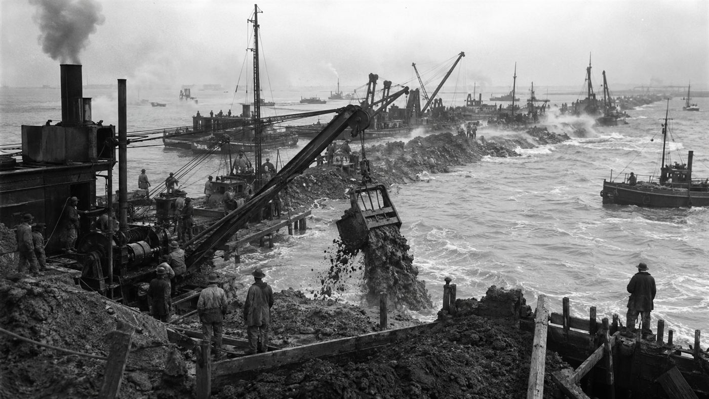
Construction ran from 1927 to 1932, and the method was brutally simple in concept and fiendishly hard in practice. Workers used boulder clay, a sticky glacial deposit dredged straight from the seabed, to build up two parallel dams and then fill between them, marching the wall out across open water from both ends. The hardest moment was the very last gap, where the tides rushed through with growing fury as the opening narrowed.
On 28 May 1932 that final gap was closed, and the Zuiderzee ceased to be part of the sea. The finished Afsluitdijk stretched 32 kilometres from the coast of North Holland across to Friesland, carrying a road along its crest. With the North Sea shut out, the rivers flowing in slowly pushed the salt away, and within a few years the trapped water became the freshwater lake known today as the IJsselmeer.
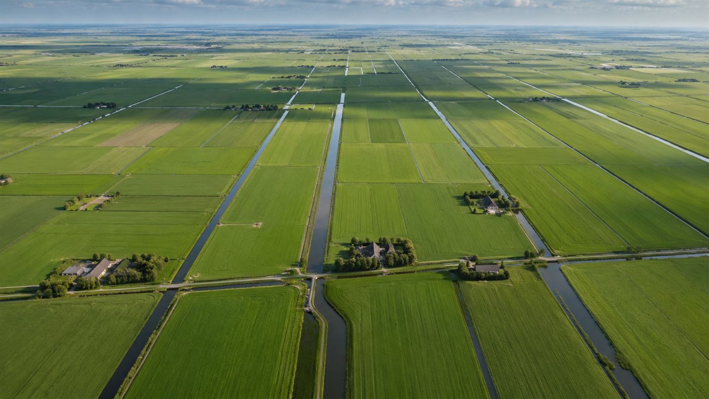
Turning a sea into land
Closing the bay was only half the ambition. The real prize was the seabed itself. With the water now calm and controllable, engineers could ring off huge areas, pump them dry, and turn them into polders, new land sitting below the level of the surrounding water. This was land reclamation on a scale never seen before, and as Britannica describes the wider Zuiderzee project, out of the old bay rose tens of thousands of hectares of fresh farmland and even an entirely new province, Flevoland.
The freshwater IJsselmeer brought its own gifts. As the Dutch tourism board Holland.com notes, it became a vast reservoir of drinking water, a buffer against both flood and drought, and a calm inland sea for sailing and wildlife. In a single generation the Dutch had taken a dangerous tidal bay and converted it into a tidy system of lake, dyke and field, with the Afsluitdijk holding the whole arrangement in place.
The honest catch
It is easy to tell this as a pure triumph of people over nature, but the Afsluitdijk drowned a way of life even as it created new land. The Zuiderzee had been a working sea, full of herring and anchovy and ringed by fishing towns that had lived off its tides for generations. When the salt water turned fresh, that fishery collapsed, and ports like Urk that had looked out to sea suddenly found themselves stranded beside a lake.
There is an ecological cost too. A whole salt-water world was switched off in a few years, and the project never fully matched its grandest plans, with one of the biggest proposed polders, the Markerwaard, never finished. Even now the dam is not a final victory: rising seas have forced the Dutch to reinforce and heighten the Afsluitdijk again in recent years. Holding back the water, it turns out, is never quite done.
Why a flat grey dam still matters
For all that, the Afsluitdijk remains one of the clearest statements of intent humanity has ever made to the ocean. Most engineering reacts to nature; this reshaped it outright, taking a sea off the map and putting a country in its place. The man who imagined it, Cornelis Lely, did not live to see it finished, dying in 1929 with the dam still a line of clay reaching across the water.
Drive across it today and there is almost nothing to see, just a low grey wall, a road, and water stretching away on both sides. But that flat horizon hides one of the great gambles of the modern age, a moment when a small, low country decided it would rather erase a sea than keep drowning beside one. It is a quietly staggering thing to have pulled off.
A nation looked at a stormy arm of the North Sea and decided to wall it off, drain it, and farm it, and somehow it worked. Was erasing the Zuiderzee a stroke of genius or an act of hubris we should think twice about repeating? Tell us in the comments.
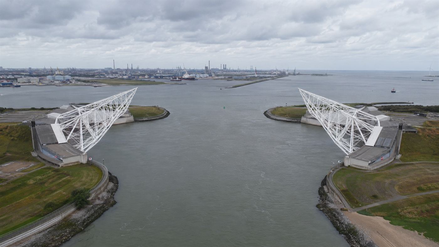
Related reading: The giant moving barrier that closes itself by computer to shield Rotterdam from the sea.